Vanishing Floodplains Increase Flood Risk Amid Climate Change
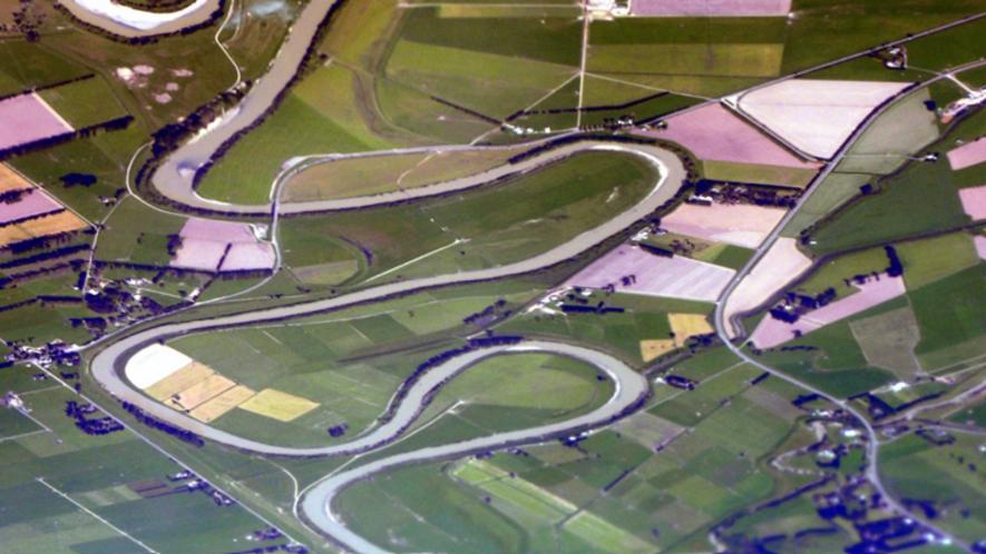
Representative Image. Courtesy Wikimedia commons.
Human settlements, from villages to megacities, have expanded rapidly in the floodplains by 85.4% between 1985 and 2015. Moreover, development in worst flood-proneareas (where water can rise more than 150 cm) has increased by a staggering 122%, outpacing the growth in flood-safe areas. The trend risks human and economic losses further when climate change poses greater threats to humanity.
A recent study published in Nature has mentioned these findings with a warning for near future, especially when climate change is intensifying flood-related disasters worldwide.
Jun Rentschler, a World Bank economist and the lead author of the study, was quoted in Xiaoying You’s article about the research findings: “In a time when human settlements should be adapting to climate change, many countries are actually rapidly increasing their exposure to floods. This is a concerning trend, especially as climate change is intensifying flood disasters worldwide.”
The research article referred to floods resulting from rising rivers and torrential rain along with coastal flooding because of sea-level change and storm surges as well.
WHAT ARE FLOODPLAINS
A floodplain is referred to a flat land adjacent to a river or stream. A floodplain stretches from a river’s bank to the base of the enclosing valley. Floodplains see flooded during heavy rains.
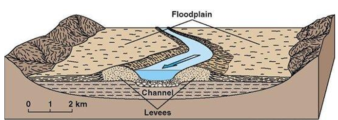
The floodplain of a river. Image taken from Rossett Geography Department and used for representation only.
Floodplains have two parts—one is the river’s main channel called the floodway and the other is the flood fringe, the portion outside of the floodway. Floodplains are homes to wide-ranged biodiversity.
Floodplains have differential tendencies of seasonal flooding. The Nature research findings suggest that around 36,500 sq km of land developed lie in the very high-hazard regions, where, as mentioned earlier, water can rise greater than 150 cm. Moreover, around 76,000 km lie in the high flood-hazard regions, where water can sire within the range of 50 cm-150 cm.
The researchers also revealed a differential pattern of flood exposure worldwidethough it is a general trend everywhere. They found that East Asia and the Pacific region are most exposed to floods, meaning these regions have more areas developed in floodplains, inviting more floods. Data from 2015 suggests that 18.4% of all the settlements in these areas were prone to flooding.
On the other hand, North America and Sub-Saharan Africa are least exposed. Here only 4.5% and 4.6% of settlements are exposed to flood hazards.
OTHER STUDIES SHOWS SIMILAR WORRYING SITUATIONS
In July, a study published in Scientific dataled by Adnan Rajib, of University of Texas, Arlington, USA, assessed the vanishing floodplains of world during 1992-2019. The assessment suggested that during those 27 years, world lost around 600,000 sq km of floodplains. Floodplains have been 1.75 times more affected than areas outside of floodplains, the study found.
Using data of the National Aeronautics and Space Administration’s (NASA) Shuttle Radar Topography Mission andthe European Space Agency, the researchers found that around 460,000 sq km of floodplains have been converted to agricultural land during the period.
The researchers studied six major basins and found a differential land use changes. North America’s Great Lakes Basin had witnessed change of forested floodplains into urbanisation whereas the Nile Basin got grasslands transformed into agricultural land. Asia’s Yangtze Basin saw the development of agricultural land.
“Floodplains have historically been used for human settlement and food production and these uses compromise the ability of floodplains to provide other ecosystem services such as clean water and flood control,”Ellen Wohl, a fluvial geomorphologist at Colorado State University, was quoted as saying in an article about the findings by Deepa Padmanaban.
Previous study from China also found a similar trend where Yu Kongjian, who proposed the sponge city concept for China, found that nearly 70% of China’s development during three decades prior to 2010 took place in floodplains.
Rentschlerwas quoted to have said: “Development on flood plains is driven mainly by land scarcity.In many areas, much of the safe land suitable for development is already occupied, forcing new development into areas that were previously avoided because of flood risk.Countries face trade-offs between economic opportunities and disaster risk.”
The researchers plan to continue monitoring the urbanisation trend and the risk of climate change in a way that they can identify high-risk developments early on and warn the local authorities.
Get the latest reports & analysis with people's perspective on Protests, movements & deep analytical videos, discussions of the current affairs in your Telegram app. Subscribe to NewsClick's Telegram channel & get Real-Time updates on stories, as they get published on our website.